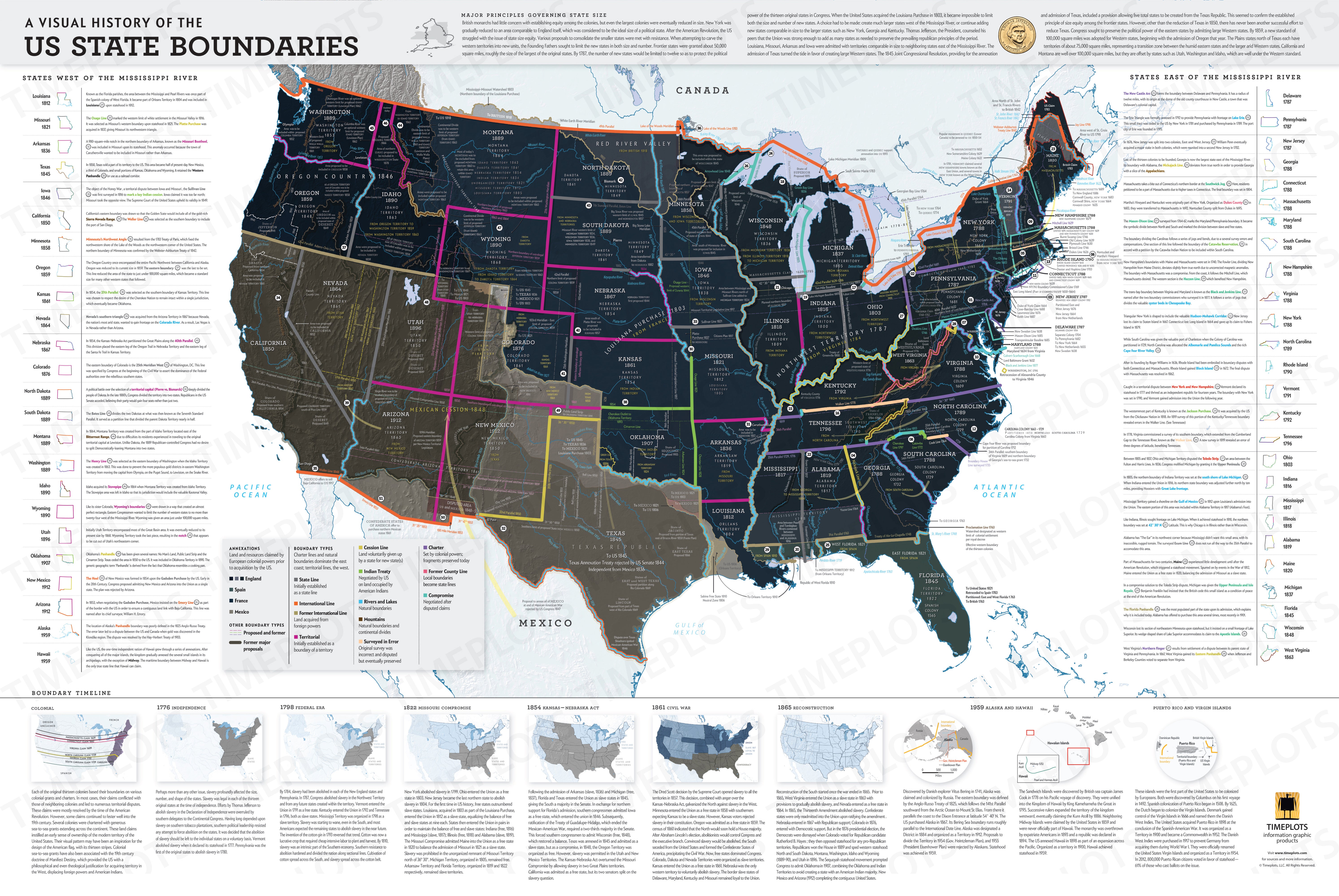
This poster is a gorgeous visualization of the history of US state boundaries. On a 36''x24'' poster, you get an overview of current and past US state boundaries throughout the country's entire history.
The poster conveys an incredible amount of information such as waterways, terrain, territory changes, the story of how slavery influenced state's formation, boundary types of each state, and more.
Part of the information on the poster can be explored through this interactive graphic.


